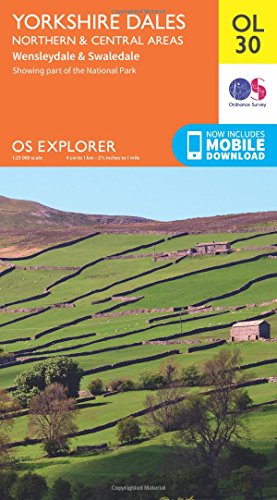
Ordnance Survey:Yorkshire Dales - Northern & Central areas 1 : 25 000 (OS Explorer Map) : Wensleydale & Swaledale
- livre d'occasion ISBN: 0319263355
[EAN: 9780319263358], [PU: Ordnance Survey], GROSSBRITANNIEN / LANDKARTE, ATLAS; KARTE;, Gebraucht - Sehr gut sg - ungelesenes mängelexemplar, gestempelt, mit leichten lagerspuren - Map s… Plus…
[EAN: 9780319263358], [PU: Ordnance Survey], GROSSBRITANNIEN / LANDKARTE, ATLAS; KARTE;, Gebraucht - Sehr gut sg - ungelesenes mängelexemplar, gestempelt, mit leichten lagerspuren - Map sheet number OL30 in the OS Explorer map series is the map of choice for people visiting the Northern and Central areas of the Yorkshire Dales, including Wensleydale & Swaledale. There is wealth of scenery in this part of the Yorkshire Dales National Park. Highlights of the area include: The valleys of Swaledale and Arkengarthdale, Aysgarth Falls, Hawes, and the River Wharfe. Includes mobile download With this map you will receive a code for use on your iOS or Android smartphone or tablet. Find our more at Mobile Download FAQ. The OS Explorer map for Yorkshire Dales - Northern & Central Area is available in both the standard paper version and weatherproof 'Active' version. From Great Black Hill to Ramsgill, the OS Explorer map of the North and Central Yorkshire Dales pinpoints every house and hill, pub and place of interest, making it the perfect fold-up companion for visitors and locals alike. Easy to understand, whether you're an occasional ambler or a highly-experienced hill walker, follow the Dales Way recreational path or the Pennine Way national trail, and soak up some of the most spectacular scenery in the North of England. With their legacy of ancient Norse culture, explore the Swaledale and Arkengarthdale valleys. Get a real sense of the area's history, climbing mountains with good Viking names, like Great Shunner Fell and Rogan's Seat. Aysgarth Falls - with scenery that inspired Ruskin, Turner and Wordsworth - is a natural wonder not to be missed. While the River Swale, the fastest flowing river in England offers opportunities for some serious canoeing. Follow your map to the spectacular triple flight of falls carved out by the River Ure. A product of the Ice Age, the falls boast a dramatic 30ft drop over limestone steps. Whether you fancy a spot of fishing on the River Wharfedale or cheese tasting at the Wensleydale Creamery, you'll get so much more out of your excursion in the North and Central Yorkshire Dales with the OS Explorer OL30 safely stowed in your knapsack. Add a copy to your basket today, and start planning your next day out in the Dales. Englisch, Books<
| | AbeBooks.deAHA-BUCH, Einbeck, Germany [61614070] [Rating: 5 (von 5)] Frais d'envoiVersandkostenfrei. (EUR 0.00) Details... |
(*) Livre non disponible signifie que le livre est actuellement pas disponible à l'une des plates-formes associées nous recherche.
Ordnance Survey:Yorkshire Dales Northern & Central
- nouveau livre 2016, ISBN: 0319263355
[EAN: 9780319263358], Neubuch, [SC: 0.0], [PU: Ordnance Survey Sep 2016], Neuware - Map sheet number OL30 in the OS Explorer map series is the map of choice for people visiting the Northe… Plus…
[EAN: 9780319263358], Neubuch, [SC: 0.0], [PU: Ordnance Survey Sep 2016], Neuware - Map sheet number OL30 in the OS Explorer map series is the map of choice for people visiting the Northern and Central areas of the Yorkshire Dales, including Wensleydale & Swaledale. There is wealth of scenery in this part of the Yorkshire Dales National Park. Highlights of the area include: The valleys of Swaledale and Arkengarthdale, Aysgarth Falls, Hawes, and the River Wharfe.Includes mobile download With this map you will receive a code for use on your iOS or Android smartphone or tablet. Find our more at Mobile Download FAQ.The OS Explorer map for Yorkshire Dales - Northern & Central Area is available in both the standard paper version and weatherproof 'Active' version.From Great Black Hill to Ramsgill, the OS Explorer map of the North and Central Yorkshire Dales pinpoints every house and hill, pub and place of interest, making it the perfect fold-up companion for visitors and locals alike.Easy to understand, whether you're an occasional ambler or a highly-experienced hill walker, follow the Dales Way recreational path or the Pennine Way national trail, and soak up some of the most spectacular scenery in the North of England.With their legacy of ancient Norse culture, explore the Swaledale and Arkengarthdale valleys. Get a real sense of the area's history, climbing mountains with good Viking names, like Great Shunner Fell and Rogan's Seat.Aysgarth Falls - with scenery that inspired Ruskin, Turner and Wordsworth - is a natural wonder not to be missed. While the River Swale, the fastest flowing river in England offers opportunities for some serious canoeing.Follow your map to the spectacular triple flight of falls carved out by the River Ure. A product of the Ice Age, the falls boast a dramatic 30ft drop over limestone steps.Whether you fancy a spot of fishing on the River Wharfedale or cheese tasting at the Wensleydale Creamery, you'll get so much more out of your excursion in the North and Central Yorkshire Dales with the OS Explorer OL30 safely stowed in your knapsack. Add a copy to your basket today, and start planning your next day out in the Dales. Englisch, Books<
| | ZVAB.comSmartbuy, Einbeck, Germany [82220461] [Rating: 5 (von 5)] NEW BOOK. Frais d'envoiVersandkostenfrei. (EUR 0.00) Details... |
(*) Livre non disponible signifie que le livre est actuellement pas disponible à l'une des plates-formes associées nous recherche.
Ordnance Survey:Yorkshire Dales Northern & Central
- nouveau livre 2016, ISBN: 0319263355
[EAN: 9780319263358], Neubuch, [PU: Ordnance Survey Sep 2016], Neuware - Map sheet number OL30 in the OS Explorer map series is the map of choice for people visiting the Northern and Cent… Plus…
[EAN: 9780319263358], Neubuch, [PU: Ordnance Survey Sep 2016], Neuware - Map sheet number OL30 in the OS Explorer map series is the map of choice for people visiting the Northern and Central areas of the Yorkshire Dales, including Wensleydale & Swaledale. There is wealth of scenery in this part of the Yorkshire Dales National Park. Highlights of the area include: The valleys of Swaledale and Arkengarthdale, Aysgarth Falls, Hawes, and the River Wharfe.Includes mobile download With this map you will receive a code for use on your iOS or Android smartphone or tablet. Find our more at Mobile Download FAQ.The OS Explorer map for Yorkshire Dales - Northern & Central Area is available in both the standard paper version and weatherproof 'Active' version.From Great Black Hill to Ramsgill, the OS Explorer map of the North and Central Yorkshire Dales pinpoints every house and hill, pub and place of interest, making it the perfect fold-up companion for visitors and locals alike.Easy to understand, whether you're an occasional ambler or a highly-experienced hill walker, follow the Dales Way recreational path or the Pennine Way national trail, and soak up some of the most spectacular scenery in the North of England.With their legacy of ancient Norse culture, explore the Swaledale and Arkengarthdale valleys. Get a real sense of the area's history, climbing mountains with good Viking names, like Great Shunner Fell and Rogan's Seat.Aysgarth Falls - with scenery that inspired Ruskin, Turner and Wordsworth - is a natural wonder not to be missed. While the River Swale, the fastest flowing river in England offers opportunities for some serious canoeing.Follow your map to the spectacular triple flight of falls carved out by the River Ure. A product of the Ice Age, the falls boast a dramatic 30ft drop over limestone steps.Whether you fancy a spot of fishing on the River Wharfedale or cheese tasting at the Wensleydale Creamery, you'll get so much more out of your excursion in the North and Central Yorkshire Dales with the OS Explorer OL30 safely stowed in your knapsack. Add a copy to your basket today, and start planning your next day out in the Dales. Englisch, Books<
| | AbeBooks.deSmartbuy, Einbeck, Germany [82220461] [Rating: 5 (von 5)] NEW BOOK. Frais d'envoi EUR 3.10 Details... |
(*) Livre non disponible signifie que le livre est actuellement pas disponible à l'une des plates-formes associées nous recherche.

Yorkshire Dales Northern & Central
- nouveau livreISBN: 9780319263358
Map sheet number OL30 in the OS Explorer map series is the map of choice for people visiting the Northern and Central areas of the Yorkshire Dales, including Wensleydale & Swaledale. Ther… Plus…
Map sheet number OL30 in the OS Explorer map series is the map of choice for people visiting the Northern and Central areas of the Yorkshire Dales, including Wensleydale & Swaledale. There is wealth of scenery in this part of the Yorkshire Dales National Park. Highlights of the area include: The valleys of Swaledale and Arkengarthdale, Aysgarth Falls, Hawes, and the River Wharfe. Includes mobile download With this map you will receive a code for use on your iOS or Android smartphone or tablet. Find our more at Mobile Download FAQ. The OS Explorer map for Yorkshire Dales - Northern & Central Area is available in both the standard paper version and weatherproof 'Active' version. From Great Black Hill to Ramsgill, the OS Explorer map of the North and Central Yorkshire Dales pinpoints every house and hill, pub and place of interest, making it the perfect fold-up companion for visitors and locals alike. Easy to understand, whether you're an occasional ambler or a highly-experienced hill walker, follow the Dales Way recreational path or the Pennine Way national trail, and soak up some of the most spectacular scenery in the North of England. With their legacy of ancient Norse culture, explore the Swaledale and Arkengarthdale valleys. Get a real sense of the area's history, climbing mountains with good Viking names, like Great Shunner Fell and Rogan's Seat. Aysgarth Falls - with scenery that inspired Ruskin, Turner and Wordsworth - is a natural wonder not to be missed. While the River Swale, the fastest flowing river in England offers opportunities for some serious canoeing. Follow your map to the spectacular triple flight of falls carved out by the River Ure. A product of the Ice Age, the falls boast a dramatic 30ft drop over limestone steps. Whether you fancy a spot of fishing on the River Wharfedale or cheese tasting at the Wensleydale Creamery, you'll get so much more out of your excursion in the North and Central Yorkshire Dales with the OS Explorer OL30 safely stowed in your knapsack. Add a copy to your basket today, and start planning your next day out in the Dales. Fremdsprachige Bücher 23.6 x 13.1 x 1.5 cm , Ordnance Survey, Ordnance Survey<
| | Thalia.deNr. A1039750861. Frais d'envoi, , DE. (EUR 0.00) Details... |
(*) Livre non disponible signifie que le livre est actuellement pas disponible à l'une des plates-formes associées nous recherche.
Ordnance Survey:Yorkshire Dales Northern & Central
- nouveau livre ISBN: 9780319263358
Sheet map, [PU: Ordnance Survey], OS Explorer is the Ordnance Survey's most detailed map and is recommended for anyone enjoying outdoor activities like walking, horse riding and off-road … Plus…
Sheet map, [PU: Ordnance Survey], OS Explorer is the Ordnance Survey's most detailed map and is recommended for anyone enjoying outdoor activities like walking, horse riding and off-road cycling. The OS Explorer range of OL maps now includes a digital version of the paper map, accessed through the OS smartphone app, OS Maps. Providing complete GB coverage the series details essential information such as youth hostels, pubs and visitor information as well as rights of way, permissive paths and bridleways., Travel Maps<
| | BookDepository.comFrais d'envoiVersandkostenfrei. (EUR 0.00) Details... |
(*) Livre non disponible signifie que le livre est actuellement pas disponible à l'une des plates-formes associées nous recherche.