
ISBN: 1566953901
[SR: 880898], Map, [EAN: 9781566953900], Folded Map, National Geographic Maps, National Geographic Maps, Book, [PU: National Geographic Maps], National Geographic Maps, • Waterproof… Plus…
| amazon.com Gagazet Media Gebraucht. Frais d'envoiUsually ships in 1-2 business days., Livraison non-comprise Details... |
ISBN: 1566953901
[SR: 880898], Map, [EAN: 9781566953900], Folded Map, National Geographic Maps, National Geographic Maps, Book, [PU: National Geographic Maps], National Geographic Maps, • Waterproof… Plus…
| amazon.com |

Cache La Poudre/Big Thompson : Trails Illustrated (National Geographic Trails Illustrated Map) - nouveau livre
2012, ISBN: 1566953901
[SR: 400271], Map, [EAN: 9781566953900], Folded Map, NATIONAL GEOGRAPHIC MAPS DIVISION, NATIONAL GEOGRAPHIC MAPS DIVISION, Book, [PU: NATIONAL GEOGRAPHIC MAPS DIVISION], 2012-08-02, NATIO… Plus…
| amazon.co.uk langton_info_england Neuware. Frais d'envoiEuropa Zone 1: GBP 5,48 pro Produkt.. Usually dispatched within 2-3 business days. Die angegebenen Versandkosten können von den tatsächlichen Kosten abweichen. (EUR 4.80) Details... |

ISBN: 9781566953900
National Geographic's Trails Illustrated Maps are the most detailed and up-to-date topographic recreation maps available for US National Parks, National Forests and other popular outdoor … Plus…
| wordery.com Nr. 9781566953900. Frais d'envoi, , zzgl. Versandkosten., Livraison non-comprise Details... |

2012, ISBN: 9781566953900
Trails Illustrated, Karte (gefalzt), Karte/Globus, [PU: National Geographic Maps]
| lehmanns.de Frais d'envoiVersand in 5-7 Tagen, , Versandkostenfrei innerhalb der BRD. (EUR 0.00) Details... |


ISBN: 1566953901
[SR: 880898], Map, [EAN: 9781566953900], Folded Map, National Geographic Maps, National Geographic Maps, Book, [PU: National Geographic Maps], National Geographic Maps, • Waterproof… Plus…

National Geographic Maps - Trails Illustrated:
Cache La Poudre, Big Thompson (National Geographic Trails Illustrated Map) - nouveau livreISBN: 1566953901
[SR: 880898], Map, [EAN: 9781566953900], Folded Map, National Geographic Maps, National Geographic Maps, Book, [PU: National Geographic Maps], National Geographic Maps, • Waterproof… Plus…

Cache La Poudre/Big Thompson : Trails Illustrated (National Geographic Trails Illustrated Map) - nouveau livre
2012
ISBN: 1566953901
[SR: 400271], Map, [EAN: 9781566953900], Folded Map, NATIONAL GEOGRAPHIC MAPS DIVISION, NATIONAL GEOGRAPHIC MAPS DIVISION, Book, [PU: NATIONAL GEOGRAPHIC MAPS DIVISION], 2012-08-02, NATIO… Plus…

ISBN: 9781566953900
National Geographic's Trails Illustrated Maps are the most detailed and up-to-date topographic recreation maps available for US National Parks, National Forests and other popular outdoor … Plus…
2012, ISBN: 9781566953900
Trails Illustrated, Karte (gefalzt), Karte/Globus, [PU: National Geographic Maps]
Données bibliographiques du meilleur livre correspondant

| Auteur: | |
| Titre: | |
| ISBN: |
• Waterproof • Tear-Resistant • Topographic Map
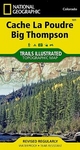
Outdoor enthusiasts looking to enjoy the recreational opportunities just east of Rocky Mountain National Park will find National Geographic's Trails Illustrated map of Cache La Poudre and Big Thompson an essential travel companion. Expertly researched and created in partnership with the U.S. Forest Service and others, the map covers parts of the Roosevelt National Forest, including Cache La Poudre River and Wilderness, Big Thompson River and Canyon, Lake Estes and Bulwark Ridge.
Get off the beaten path and back on again by following the map to clearly marked trailheads and then along trails, marked according to their designated usage, including trails which are part of the National Recreation Trail system. Also shown are Forest Service roads, many of which serve as ATV trails. To aid in your navigation, the map includes contour lines, elevations, labeled peaks and summits, water features, areas of wooded cover and color-coded boundaries between different land management organizations. Some of the recreational points of interest are campgrounds, interpretive trails, fishing areas, boat launch points and picnic areas. The Cache la Poudre Scenic Byway is marked for those who are interested in taking in the scenery by car.
Every Trails Illustrated map is printed on "Backcountry Tough" waterproof, tear-resistant paper. A full UTM grid is printed on the map to aid with GPS navigation.
Other features found on this map include: Cache La Poudre Wilderness, Roosevelt National Forest.
Map Scale = 1:40,680Sheet Size = 22" x 32"Folded Size = 4" x 7.5"Informations détaillées sur le livre - Cache La Poudre
EAN (ISBN-13): 9781566953900
ISBN (ISBN-10): 1566953901
Version reliée
Date de parution: 2012
Editeur: Rand McNally & Company
Livre dans la base de données depuis 2010-10-25T19:44:39+02:00 (Paris)
Page de détail modifiée en dernier sur 2020-09-07T19:38:01+02:00 (Paris)
ISBN/EAN: 9781566953900
ISBN - Autres types d'écriture:
1-56695-390-1, 978-1-56695-390-0
Autres types d'écriture et termes associés:
Auteur du livre: geo, mcnally rand
Titre du livre: cache, national geographic, thompson
Données de l'éditeur
Titre: Cache La Poudre - NATIONAL GEOGRAPHIC Trails Illustrated Colorado
Editeur: National Geographic Maps
Langue: Anglais
9,99 € (DE)
10,30 € (AT)
Not available (reason unspecified)
CB; GEF; Karten, Globen / Reisen/Karten, Stadtpläne, Atlanten/Nordamerika, Mittelamerika; Landkarten und Atlanten; Nordamerika (USA und Kanada)
Autres livres qui pourraient ressembler au livre recherché:
Dernier livre similaire:
9781566950022 Cache La Poudre Big Thompson Colorado USA (Creator: National Geographic Maps)
< pour archiver...